
|
This article needs a clean-up.
You can help Truck Simulator Wiki by re-organizing parts of the article, checking grammar / spelling, and doing other helpful things to correct the article.
|
- For other auxiliary Interstate Highways numbered Interstate 580, see Interstate 580 (disambiguation).
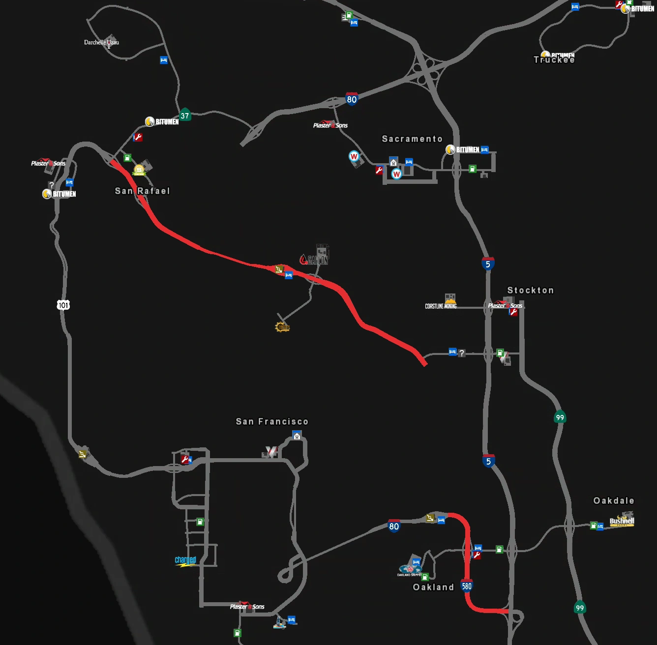
Interstate 580 (I-580) is an east–west auxiliary Interstate Highway of Interstate 80 in the San Francisco Bay Area in northern California. It runs from US 101 in San Rafael to Interstate 5 near Patterson southeast of Oakland. A section of Interstate 580 in Oakland is shared with its parent route Interstate 80.
Cities[]
California[]
San Rafael(replaced by a scenery town in the same location in update 1.44)- Oakland
Exit list[]
| Location | mi | Exit | Destinations | Facilities | Notes |
|---|---|---|---|---|---|
| San Rafael | 0 | ---- | Westbound exit and eastbound entrance; west end of I-580; road continues as US 101; US 101 exit 451 | ||
| San Francisco Bay | ---- | Richmond–San Rafael Bridge | Toll westbound only | ||
| Richmond | 7 | ||||
| 55 | ---- | Westbound TOTSO: West end of I-80 overlap; westbound exit and eastbound entrance; I-80 east exit 13 | |||
| Berkeley | 68 | 11 | University Avenue | Turnaround only | |
| Oakland | 78 | 19 A | Eastbound TOTSO: East end of I-80 overlap; I-80 west left exit 8 | ||
| 84 | 19 B | Oakland, Stockton | |||
| 121 | ---- | Eastbound exit and westbound entrance; east end of I-580; I-5 north left exit 446 |
History[]
Map of Interstate 580 in the initial version of the game.
- In the initial version of American Truck Simulator, Interstate 580 was split in two sections. The first section began in San Rafael as a continuation of a then terminus of US 101. It headed southeast via the Richmond–San Rafael Bridge until ending at an at-grade junction with SR 4 to Stockton. The second section began in Oakland as a continuation of a then terminus of Interstate 80 from San Francisco. From there, it turned to the south and continued to its terminus at a trumpet interchange with Interstate 5.
- In update 1.5, as part of the 1:35 to 1:20 map rescale, the section of Interstate 580 from Oakland to SR 4 was added. The section south of Oakland was remade and lengthened, and the trumpet interchange with Interstate 5 was changed to a half-trumpet interchange.
- In update 1.44, as part of the second phase of the California rework, the section of Interstate 580 from US 101 in San Rafael to Interstate 80 in Berkeley was completely reworked. The diamond interchanges in San Rafael and Richmond were removed as SR 4 was removed west of Stockton and SR 37 was moved north, and all other junctions were rebuilt. San Rafael was completely reworked and replaced by a scenery town in the same location.
Gallery[]
")
Richmond (before update 1.44)
")
Richmond–San Rafael Bridge (before update 1.44)
See also[]
| Cities | Bakersfield - Barstow - Carlsbad - El Centro - Eureka - Fresno - Hilt - Huron - Los Angeles (Santa Monica) - Modesto - Oakland (Richmond) - Oxnard - Redding - Sacramento - San Diego - San Francisco - San Jose - Santa Cruz - Santa Maria - Stockton - Truckee - Ukiah List of scenery towns in California |
|---|---|
| Highways | Interstate 5 - Interstate 8 - Interstate 10 - Interstate 15 - Interstate 40 - Interstate 80 - Interstate 580 US 6 - US 50 - US 95 - US 97 - US 101 - US 199 - US 395 SR 1 - SR 3 - SR 4 - SR 14 - SR 16 - SR 27 - SR 36 - SR 37 - SR 44 - SR 58 - SR 74 - SR 89 - SR 99 - SR 110 - SR 111 - SR 120 - SR 121 - SR 126 - SR 130 - SR 139 - SR 152 - SR 180 - SR 190 - SR 198 - SR 255 - SR 273 - SR 299 |
| See also | List of landmarks in California - List of Truck Stops in California |